ENVIRONMENTAL FACTORS 1

In the 10,000 years since the last Ice Age, the wide mouthed Dee Estuary has naturally silted up due to a lack of tidal scour. During the early 18th century, efforts to preserve a navigable channel to Chester included canalising the Dee in the upper estuary and moving the main channel away from the English to the Welsh shore.
By 1900 a seawall extended along nearly the whole of Hoylake’s north coast. This wall has removed the natural conduit for blown beach sand to create and feed a sand dune ecosystem and affected the general profile of the beach.
Prior to this, the North Wirral Coast consisted of a long line of low dunes built up from blown sand and with a profiled sandy beach all the way from Hoylake to Wallasey. Evidence of this remains at Leasowe Bay at a point where there is a gap in the man made revetment walls.
All these changes, both natural and man-made, affected Hoylake’s offshore channels and tidal currents to deliver a substantial raising of beach levels over the last century. However, it is the construction of seawalls that has had the most impact on the natural beach form in Hoylake.
Today, the beach is ‘managed’ to prevent wind-blown sand engulfing the promenade and to discourage the development of saltings (marshy growth). The result is that we have a flat and wet upper beach which is rarely washed clean by the tide.
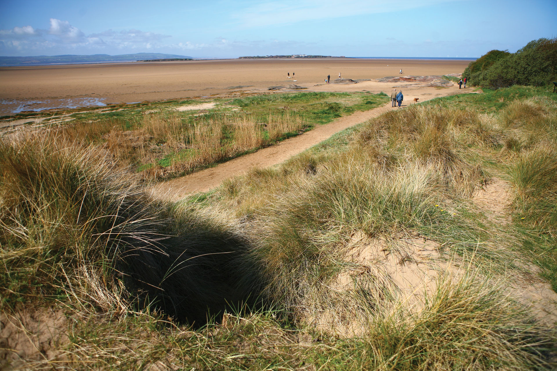
Sand dunes and wet ‘slacks’ near Red Rocks (opposite) have developed gradually over the last century. Initial saltings in front of the older dunes are first shown on the 1927 OS map.
Some 80+ years later these saltings have been succeeded by fresh water slacks and a low dune ridge fronted by a narrow band of saltings upon which a new line of embryo dunes are establishing themselves as the coast moves slowly seaward.
However, this area, designated as a SSSI, a Site of Special Scientific Interest, has been downgraded by Natural England to a classification of ‘unfavourable declining’. This means a ‘lack of investment and positive management or a period of wilful neglect’ requires imminent intervention to prevent further, more serious decline and to conserve the special wildlife and geological features of this site.
Current classifications in the areas adjacent to Hoylake beach include:
- Dee Estuary RAMSARsite
- Dee Estuary Special Protection Area(SPA)
- Mersey Narrows and North Wirral Foreshore pSPA (potentialSPA)
- Dee Estuary possible Special Area of Conservation (SAC)
- North Wirral Foreshore Site of Special Scientific Interest (SSSI)
- Meols Meadows SSSI
- Red Rocks SSSI
- Dee Estuary SSSI
- Hilbre Island Local Nature Reserve (LNR)
These designations clearly indicate that we live in a very special coastal environment; one worth conserving and improving where there is evidence of decline.
Look at the picture above, then think about Hoylake beach as it is right now. It's not right, is it?